
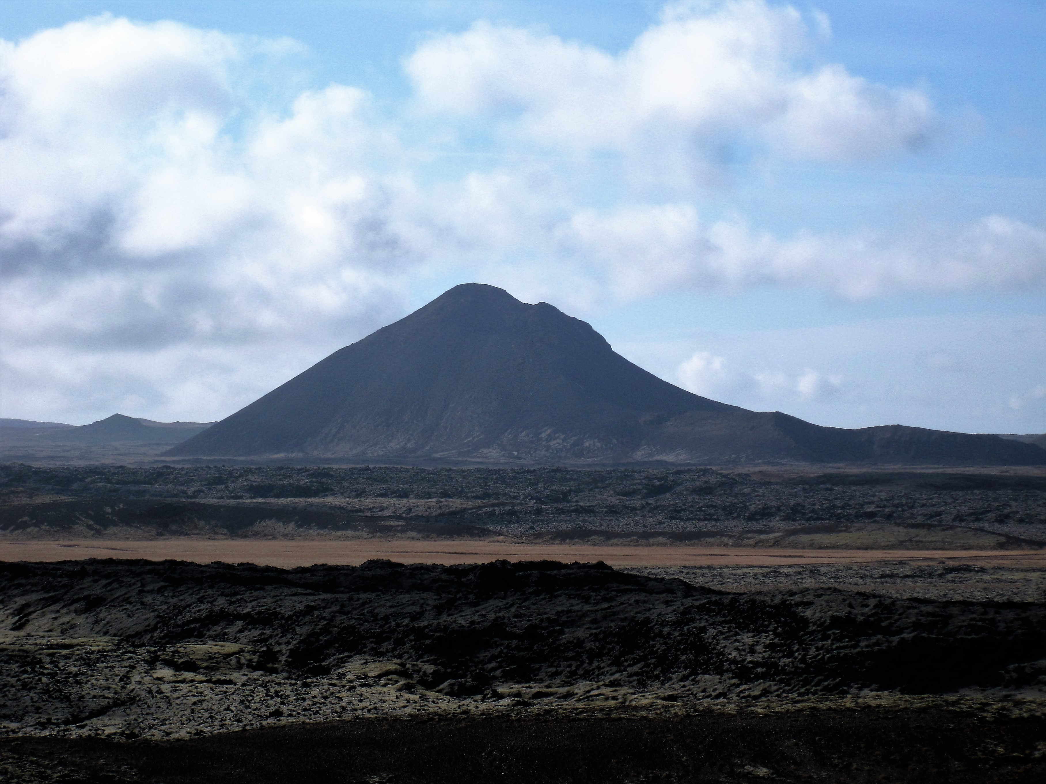
Mt. Keilir is the signature mountain of Vogar and Reykjanes Geopark. Its unique cone shape makes the mountain stand out, and it is visible from afar. Mt. Keilir is a tuff mountain which formed in an ice age, in an eruption beneath a glacier which did not break through the thick ice. To get to Mt. Keilir, you take the Reykjanes road (no. 41) and turn off as if you mean to take Vatnsleysustrandarvegur (no. 420), the road to the mountain is at the same junction but lies in the opposite direction. There is a sign guiding the way. The road itself is a rough and bumpy gravel road. It is passable for most cars in summer, but smaller cars must be driven very slowly the 8 kilometres to the car park at Mt. Oddafell´s northern end. The hike itself is suitable for almost everyone, Mt. Keilir is not nearly as steep as it looks from a far. The first leg is a fairly easy 3 km walk to the mountain, and then you take the paths up the slopes. Sometimes people slip on the slopes, you may need to use your hands for additional support, those who are afraid of heights may find it a bit much, but most people will get up with good encouragement from their fellow hikers. In winter, the gravel road to the mountain is normally closed, but if you get the opportunity to climb it, you should bring crampons and an ice axe.
The trail is sponsored by Icewear and is therefore free for users of the Wapp – Walking app.
Download the route for free and enjoy a wonderful hike!

Leave A Comment