Explore the Icelandic Outdoors with Wapp
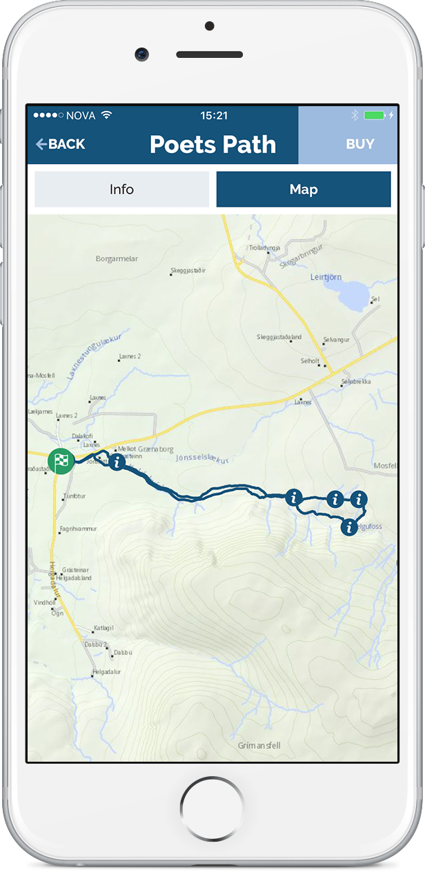
The Wapp is a free app with a collection of GPS tracks for hiking, trekking or walking in Iceland with various information on nature, history, folk tales and the environment in general. The tracks are combined with a detailed map and are downloaded beforehand and used offline.
![]()
![]()
Wapp
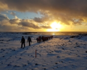
Why not take a tour with the Wapp and have an adventure outdoors using GPS activated pop-up facts, stories and photos on the area. The trails are of great variety and the experience meaningful and full of joy. It’s not just about reaching the end but also enjoying the overall experience on the way.
Try our new variety of trails in Iceland equipped with the important safety measure of always knowing your location as the route progresses.
Main features:
· Displays varied trails in Iceland by using your phone as a personal travel guide.
· Store trails on your phone for offline use.
· Collection of nearby trails will easily be visible and accessible on your phone
· Opens up possibilities of diverse trips or exploring new areas.
· Simple search by length of trip, elevation, difficulty or territory.
Downloading the Wapp and routes:
When downloading the Wapp – Walking app please remember to allow the Wapp – Walking app access to the location of the phone, otherwise, the Wapp will not function because the location is the basis of the app. If the Wapp – Walking app starts in Icelandic then it is easy to switch to English by pressing the menu in the top left corner and press the Icelandic flag and then the English speaking flag appears and must be pressed. Please bear in mind that if something doesn’t work properly in the Wapp – Walking app it can be a good idea to turn it off and start again just like with any other computer program.
The routes on the Wapp – Walking app are non-consumable In-App Purchases. You buy these items one time, and you can transfer them to other devices that are associated with your Apple or Google ID. If you lose a non-consumable purchase, you will be able to download it again for free. It is recommended to remove routes from your device and download again on a regular basis. If weeks pass from the time of download until the actual usage there is a chance some routes might be updated in the meantime as info could be added or the track moved.
Some routes are “free” and marked as such in the Wapp – Walking app. Due to regulations, these downloads have to go through the same routine as the ones that cost, so customers are asked if they are sure they want to buy the route. Despite the wording of the request, there is no cost involved if the route is marked as “free”.
Once a route has been downloaded it will be found in “my routes” in the menu.
In Cooperation With
Wapp cooperates with multitudes of companies and institution
A leading app developer in Iceland, Stokkur, programmed Wapp.
Samsýn specializes in geographic information system (GIS) and cartography in Iceland. All the maps in Wapp is courtesy of Samýn.
PWC keeps the Wapp books, publishes annual reports and serves as an advisory to the operations.
112 is the national emergency number. Notifications are sent from Wapp to 112 at the start and finish of a trail. This is for emergency only and data will not be used unless someone is reported missing.

The Katla Unesco Global Geopark of Iceland is cooperation with the Wapp. The aim is to introduce beautiful trails and sites in the Katla Unesco Global Geopark in the southern part of Iceland.
HEY Iceland sponsors 20 routes all over Iceland in the Wapp Walking app.
The Cultural Heritage Agency of Iceland has signed a memorandum of understanding of cooperation. The aim is to introduce sites in Iceland that are of historical and cultural importance.
The Reykjanes Unesco Geopark of Iceland is cooperating with the Wapp and sponsors beautiful trails in the Geopark.
The Iceland Touring Association supports the Wapp financially and sponsors trails like Esja and Laugavegur within the Wapp.
Icewear sponsors trails in the Vik area in Katla Geopark and one trail in Reykjanes Geopark.
Founder
“For 30 years it has been my main interest to explore the outdoors of Iceland. It‘s not only about reaching the destination, I need to know the stories connected to the area I’m traveling through. I was greatly inspired by my grandmother Hulda Þórisdóttir. She used to take me on long hikes along the beaches and the hillsides and she had countless stories to tell where nature was put in context including mystical stories about elves and hidden people that only gifted people can see.” Einar Skúlason, founder einar@wapp.is.
Mt. Vörðu-Skeggi in Hengill
The Hengill area is an active volcanic area, both mysterious and charming, with canyons, secret lush valleys, lava plains, mudslides, caves, creeks and hot and cold pools. It is an enormously powerful geothermal field, which [...]
Mt. Hnefi
Above the so-called Melir area in Kjós (in the Reykjavik area) you can see a cliff, rising highest in a peak called Mt. Hnefi (Fist). Mt. Hnefi is very convenient for hiking, with gentle slopes [...]
Prestastígur Trail
Prestastígur (Priests´ Path) is a route that´s been travelled for ages but the name itself isn´t very old. As the name indicates, priests used to travel this route although they were outnumbered by the fishermen [...]
Kerhólakambur in Mt. Esja
Seen from Reykjavík, Kerhólakambur (Kerhólar Crest) looks to be Mt. Esja´s highest point. It isn´t, but nevertheless it is majestic, the trail beautiful and the view is great. We travel through the setting of Kjalnesinga [...]

Remember that you are always responsible for your own safety when you hike unaccompanied in Iceland.
Using the Wapp – Walking app safely
- Keep in mind that the mobile phone battery can run out. Consider bringing an external battery pack to recharge your mobile phone while hiking.
- Some mobile phones are fragile and cannot handle rain. Consider bringing a waterproof case for your phone.
- In each route the general conditions and level of difficulty is listed according to standards issued by the Icelandic Tourist Board. Please choose routes that fit your level of fitness and experience in hiking.
- The Wapp is cooperating with the 112 response center. When you start a trail you are offered to “check in” and send your location to the 112 response center. The text message is free of charge. Remember that even though your phone shows no signal there is a possibilite that you can send text message. Only the 5 last locations are stored with 112 and it’s recommended to use this feature. You are not disturbing anyone – except for their big computer who wants to be disturbed.
- If there has been a while since you downloaded the route it is recommended to remove it from the mobile phone and download it again if there are any updates. The routes don’t update automatically. You will not be charged twice for the same route so any updates are free.
Guidelines for hiking in Iceland
The following information are the guidelines that Safe travel Iceland sets and every hiker is encouraged to study it well in advance.
To ensure a better hike keep this in mind:
- When choosing a hiking trail, hikers should always use themselves as a frame of reference, i.e. their level of fitness and their experience and knowledge of hiking.
- Don’t set out to do too much, plan reasonable distances each day. For most hikers around 3,5 km. pr. hour is enough.
- Keep in mind that even though a trail may have markers, visibility can be so poor that it is not possible to see from one mark to another.
- Compasses and GPS devices should be brought, alongside the knowledge of how to use them.
- A travel plan is an important aid for every hiker. With a route plan you can plot day trips, distance to hike each day, write down accommodation details, a contingency plan if that might be needed, and other things that are important in making a good hike even better.
- The route plan should be left with a trustworthy person. He or she will then have exact information about the trip, in the event that a situation may arise in which it is needed.
Hikers should consider:
- To keep an eye on their hiking companions; you never know when exhaustion or something else will kick in.
- If induced repetitive strain injuries begin to crop up, stop immediately and mend them as well as possible. Don’t delay as that only makes matters worse.
- Be prepared for sudden weather changes and check the daily weather forecast with the ranger or warden before you start your hike each day.
Stick to the travel plan that was arranged before you left. If you change your travel plan, let the person who only has a copy of the original know about the alterations or write the changes down in guest books at lodges. - Make a point to always write your name and the date in guest books for security reasons.
- Do remember to properly organise your backpack. The heaviest objects should be placed closest to the back. Ensure that the backpack is not too heavy (15-18 kg); if it is, it can ruin an otherwise pleasant hike.